Landscape

Site Analysis, Feasibility & Appraisal Studies
This is the initial, strategic stage of every project.
Site Analysis, Feasibility and Appraisal Studies involve the analysis of the area to determine the best development layout for the site, balancing both the desired development use and function and the merits of the site and the landscape setting.
Click the Read More button below to find out further about Site Analysis, Feasibility & Appraisal Studies and how we can assist you.
Let's work together
Get in touch Read more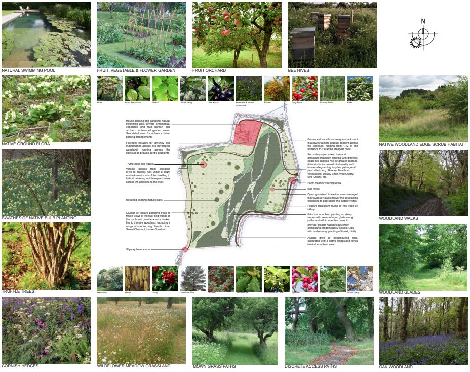
Initial Concept Designs
The design process starts with a detailed brief from the client and a clear understanding of their aspirations for the space. Our landscape team will carry out a full site survey, taking into account existing features of the site, including boundaries, buildings, levels and orientation, highlighting practical and aesthetic considerations, before drawing up initial concept plans.
Click the Read More button below to find out further about Initial Concept Designs and how we can assist you.
Let's work together
Get in touch Read more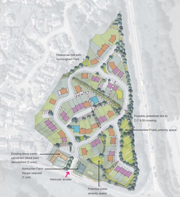
Masterplanning & Urban Design
Our multidisciplinary approach means we deliver holistic design, between buildings and outdoor spaces, the existing, retained site features and the landscape setting, be it a rural or urban one working within the site’s constraints to maximise its potential.
Click the Read More button below to find out further about Masterplanning & Urban Design and how we can assist you.
Let's work together
Get in touch Read more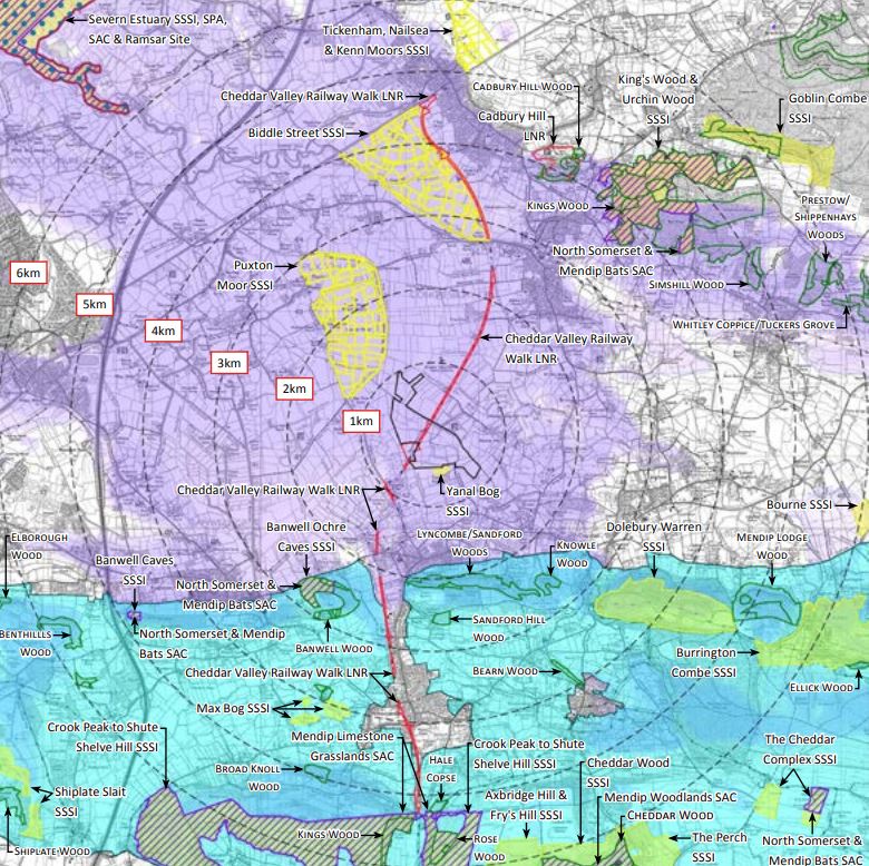
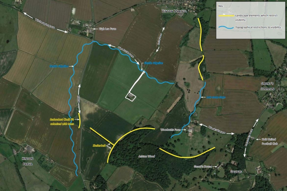
Landscape & Visual Impact Assessment (LVIA)
A Landscape and Visual Impact Assessment helps identify and mitigate the effects of new developments on both the landscape of the site and the wider setting and also on the ‘visual receptors’, i.e., the people who will experience the landscape, e.g., residents, visitors, walkers and drivers.
Click the Read More button below to find out further about Landscape & Visual Impact Assessment (LVIA) and how we can assist you.
Let's work together
Get in touch Read more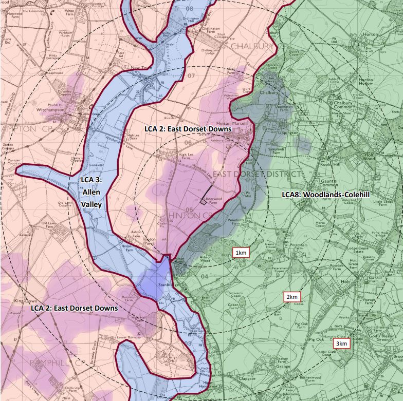
LVIA forming part of Environmental Impact Assessments (EIA)
An Environmental Impact Assessment (EIAs) is an objective study of the potential environmental impact, both positive and negative, of major development proposals.
It’s a comprehensive process, usually requested by the Local Planning Authority, whereby specialist reports and assessments are incorporated into the Environmental Statement as separate chapters.
Click the Read More button below to find out further about LVIA forming part of Environmental Impact Assessment and how we can assist you.
Let's work together
Get in touch Read more

Expert Witness at Appeal
Senior members of the landscape team are experienced in preparing documentation and when required, testimony as an expert witness, to support our clients and their projects at appeal, ranging from written representation, hearings and public inquiry.
Click the Read More button below to find out further about Expert Witness at Appeal and how we can assist you.
Let's work together
Get in touch Read more
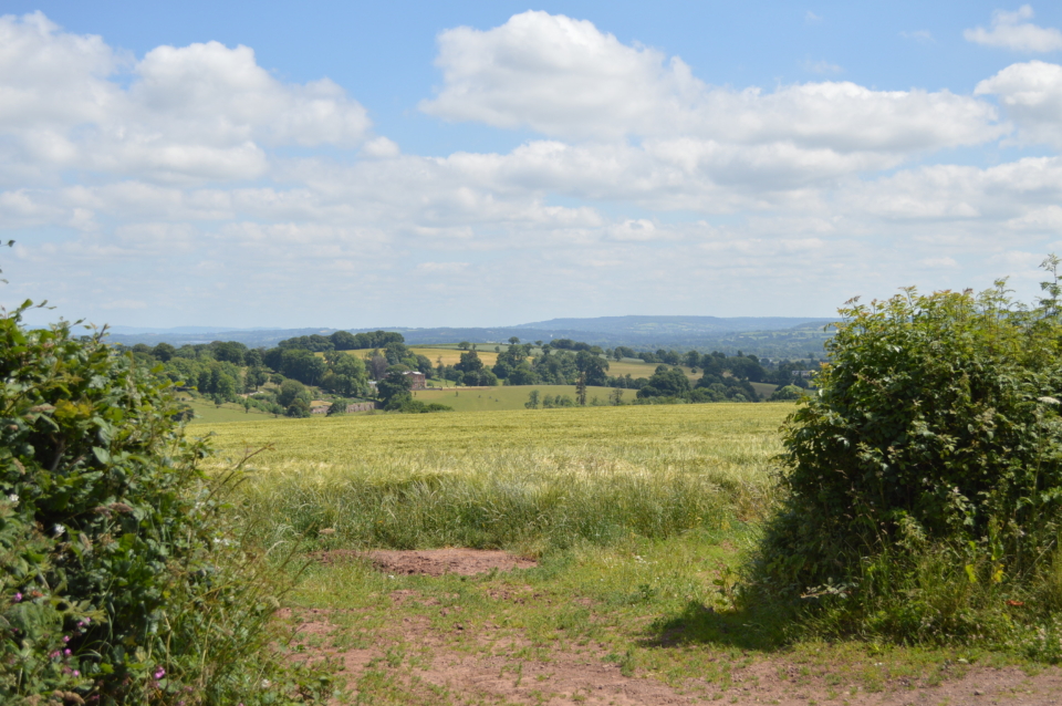
Landscape / Visual Appraisals
Appraisals provide a review of a site and its setting to ascertain the sensitivity to accommodate a particular development in landscape and visual terms.
It is often used when the full LVIA is not required but understanding more about the local landscape and the visibility of the site, would be beneficial at the outset of a project, when this process can inform the Site Analysis and Feasibility stages, helping to identify potential constraints and opportunities at an early stage.
Click the Read More button below to find out further about Landscape / Visual Appraisals and how we can assist you.
Let's work together
Get in touch Read more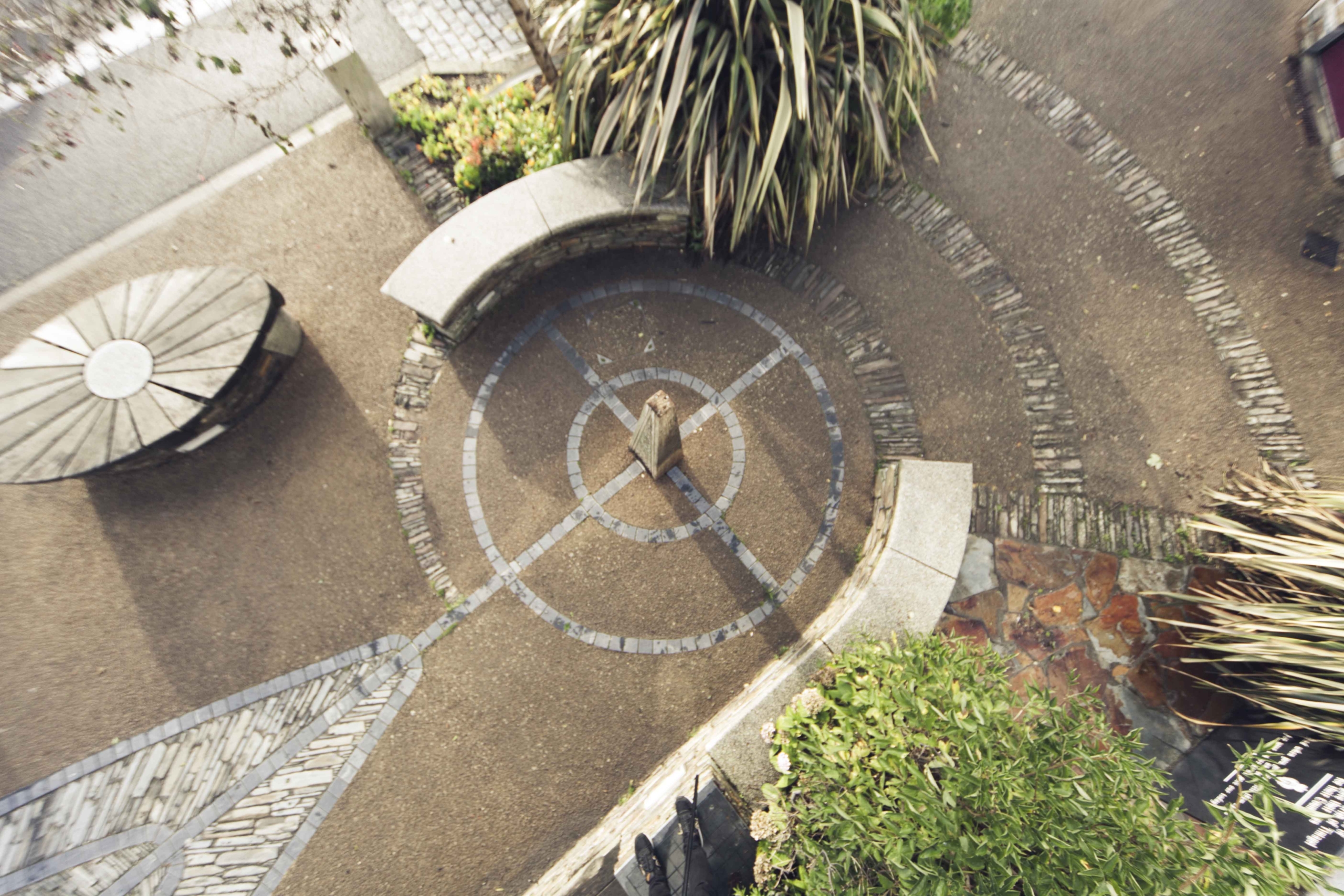
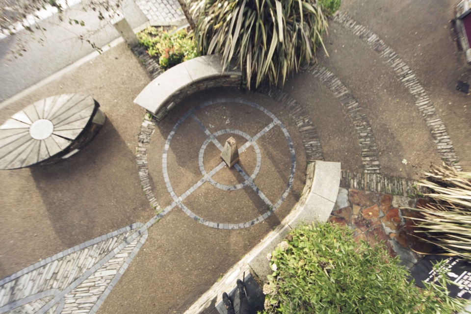
Detailed Hard & Soft Landscape Design
Hard landscaping is the term applied to permanent architectural features, ranging from paths paving, walls and fences to pergolas, ponds and patios. Soft landscaping is the living part of the space: the soil and turf, trees and shrubs.
Click the Read More button below to find out further about Detailed Hard & Soft Landscape Design and how we can assist you.
Let's work together
Get in touch Read more

Landscape & Ecology Mitigation Management Plans & Maintenance Schedules
Landscape and ecological management and maintenance plans (LEMMP’s) are often required to support planning applications or satisfy planning conditions.
Click the Read More button below to find out further about Landscape & Ecology Mitigation Management Plans & Maintenance Schedules and how we can assist you.
Let's work together
Get in touch Read more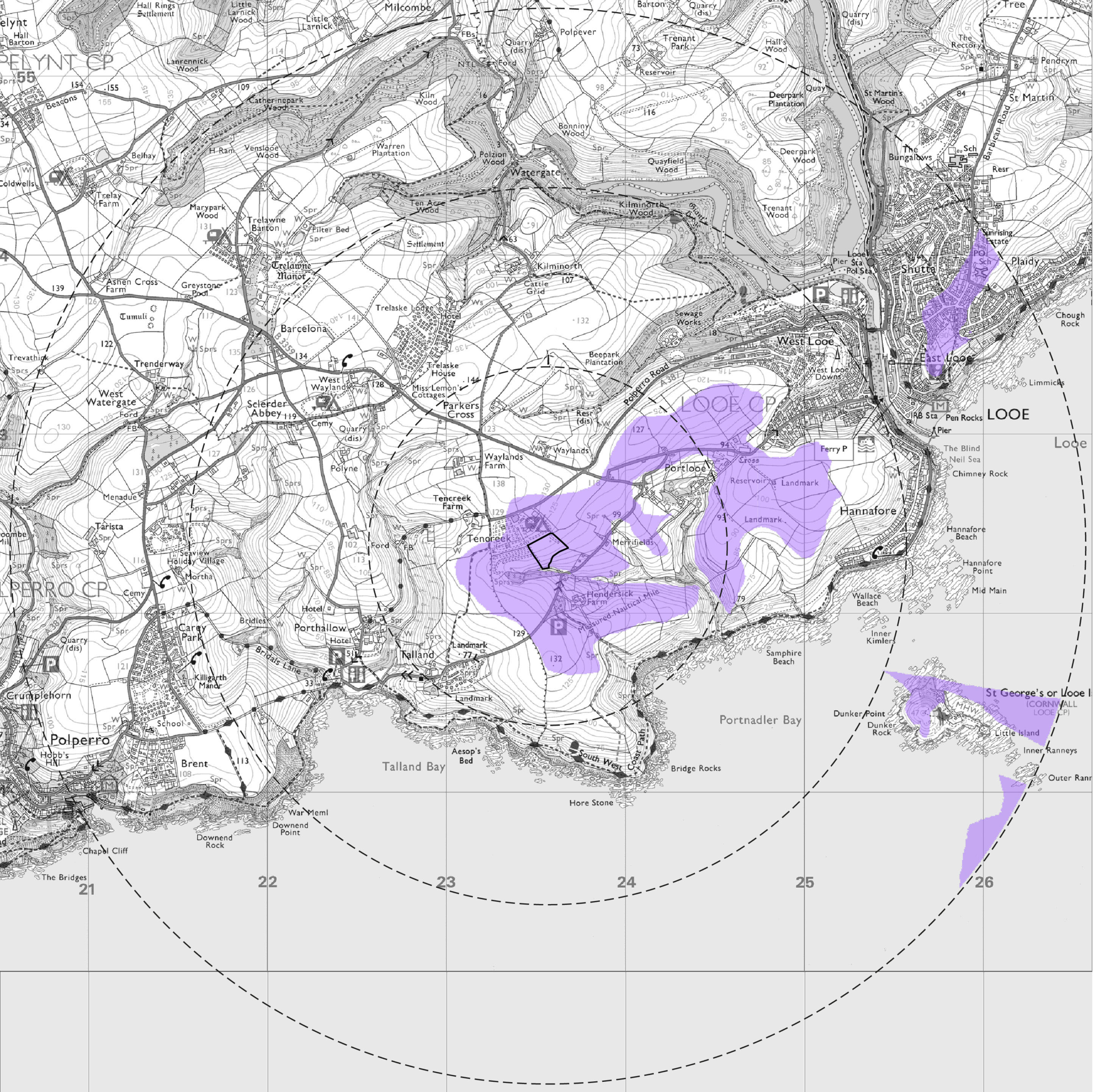

Supporting Graphics: Photomontages & Zone of Theoretical Visibility Maps (ZTV's)
Visibility mapping, referred to as Zones of Theoretical Visibility (ZTVs) are generated on three dimensional modelling software such as Key TerraFirma.
Click the Read More button below to find out further about Supporting Graphics: Photomontages & Zone of Theoretical Visibility Maps (ZTV’s)and how we can assist you.
Let's work together
Get in touch Read more
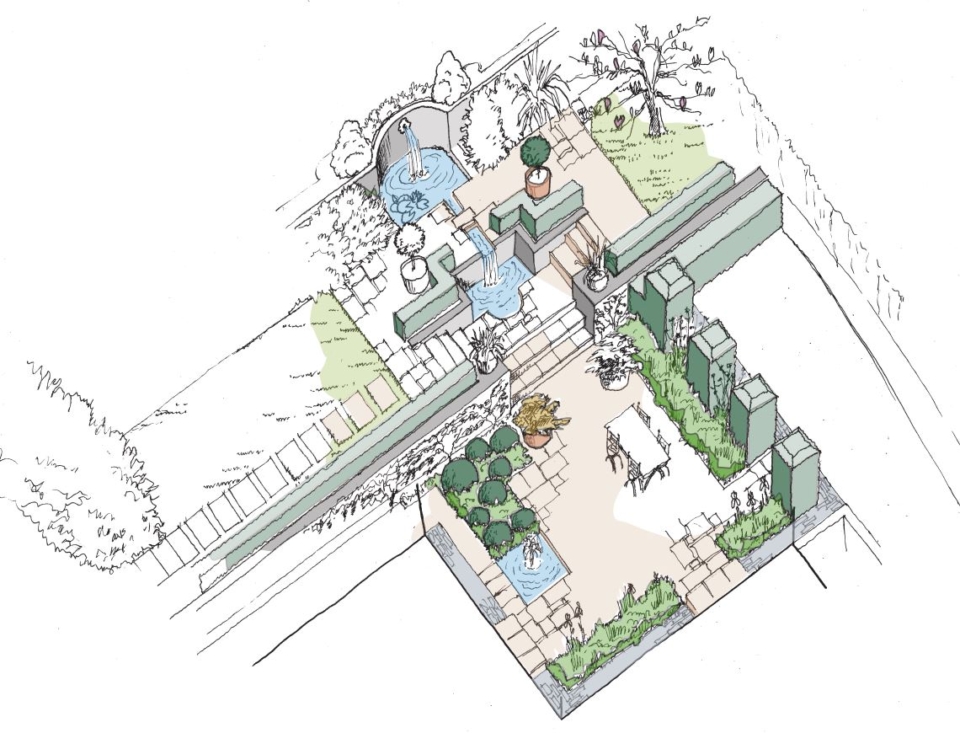
Garden Design
We offer a range of garden design services. Commencing with an initial consultation to view your private space and develop the brief, while gaining an insight into the scale, the existing setting and features, balanced with your hopes and ambitions for turning a ‘space’ into a ’place’ – somewhere treasured to wake up to, to linger in, to entertain, relax, play and exercise within – a retreat and a sanctuary.
Click the Read More button below to find out further about Garden Design and how we can assist you.